Stearns County Ditch 25 (CD25)
Stearns County Ditch 25 (CD25) was established in 1905. The ditch is 3.1 miles in length and contains roughly 1,681 benefitted acres. CD25 is both a legal county ditch and public waters. The DNR requires review of any drainage projects that may impact public waters and may also require a permit for work in the ditch or a letter of permission.
The DNR review is based on concerns that a repair project may negatively impact Kepper Lake by draining water levels lower than the run out elevation.
Overview Map of CD25
Links
Click on the links to review the various ditch reports and maps.
Status Update 9/4/2019
As part of the maintenance of CD25, Stearns County will be spraying noxious weeds and other brush along the ditch for the purpose of maintaining the excavation that was recently done in the ditch. The excavation has made the ditch capacity much greater and with less water, weeds have begun to grow. The spraying is expected to occur in the middle of September weather permitting. Please contact Stearns County with any questions or concerns by phone at 320-656-3694 or by e-mail at County.Drainage@co.stearns.mn.us.
Inspection Report
This document contains information collected about CD25 from 2015 to present. It includes photos and summary of field visits about the condition of the ditch.
Profile Evaluation Report
An Engineers report commissioned by Stearns County for the purpose of reestablishing the original elevation profile from 1905. Because no one knows exactly what was built in 1905, Minnesota law allows a licensed engineer to use all available information to create an elevation profile.
This information allows Stearns County to compare current ditch conditions to the original design.
In response to a 2016 DNR concern, this report also reviews how a ditch repair may or may not impact Kepper Lake.
CD25 Overview Map
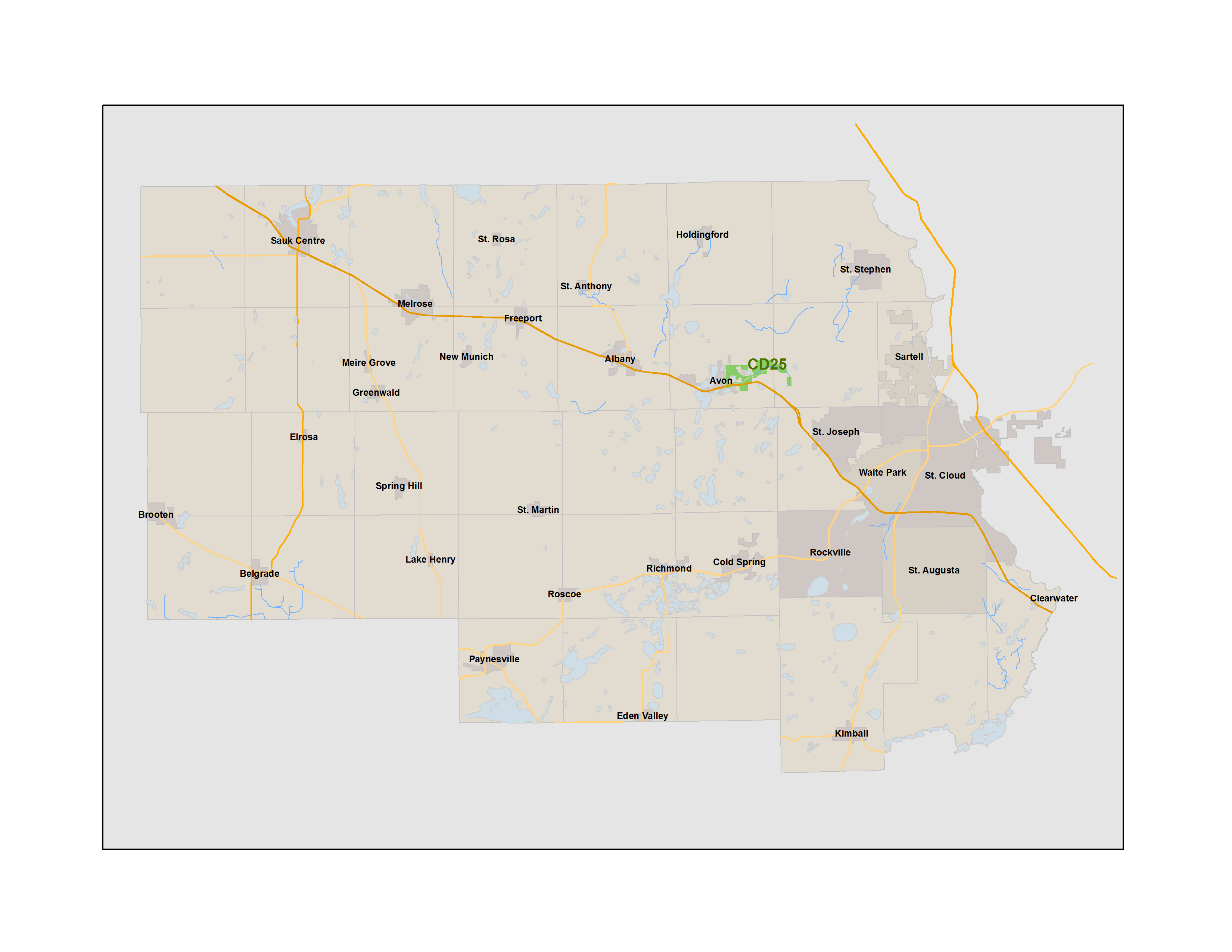
This map shows the location of CD25 within Stearns County
CD25 Drainage System Map
This map shows the ditch channel location as well as the legal benefit of the CD25 drainage system, which is shown in green. In 1905, all property shown in green was determined to benefit from CD25.
Map with 1939 image overlay
This is a copy of the Drainage System Map with an overlay of an aerial image from 1939 covering the town site of Avon.
Ditch Repair Plan
The ditch repair plan. Approved by the Stearns County Board of Commissioners, acting as Drainage Authority on 6/20/17.
Estimated Costs
This page provides estimated project costs based on the vendor bids that Stearns County has received. The cost numbers are for informational purposes and are subject to change.
Debris Clean-up May 4, 2017
This document shows before and after pictures of the area of CD25 where debris was removed by Stearns County on May 4th, 2017. The first 8 photos were taken before the clean-up and the last 8 photos were taken after the clean-up.
Flight from October 16, 2018. This is resulting video of the flight. (No audio)
Flight from May 15th-17th 2017. This is resulting video of the flight. (No audio)